Start Your Amador Wine Country Adventure
Amador County sits in the foothills of the Sierra Nevada mountain range, placing us in close proximity to several metropolitan areas including Sacramento, Reno, Nevada, and Lake Tahoe. We are a short drive from cities in California’s Central Valley and an easy getaway from anywhere in the San Francisco Bay Area.
Our closest major airport is in Sacramento, about an hour’s drive away. While a short drive from many destinations, Amador Wine Country is worlds away from the everyday.
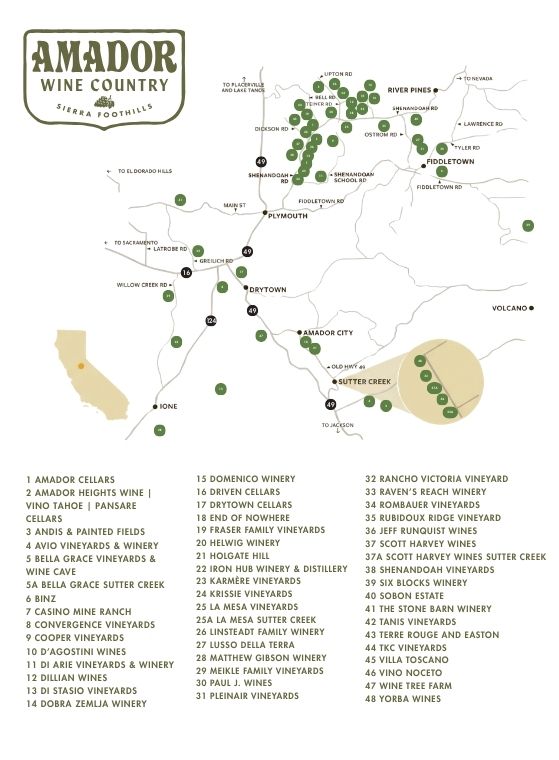
In the heart of the Sierra Foothills American Viticultural Area (AVA), there are 4 districts to discover within Amador Wine Country: Fiddletown, Greater Sutter Creek, Shenandoah, and West End.
Start your wine adventure exploring this pioneering wine region with world-renowned Barbera, Sangiovese, Tempranillo, Syrah, Viognier and Roussanne (to name a few) allowing our guests to explore many of the world’s wine varietals in one location without a passport!